The Kjalvegur Route, also known as F35, is a historic highland road in Iceland that traverses the interior Kjölur plateau, connecting the southern and northern regions of the country. This unpaved route offers travelers a unique journey between the Langjökull and Hofsjökull glaciers, showcasing some of Iceland's most remote and stunning landscapes.
Route Overview
Length: Approximately 168 kilometers (104 miles)
Duration: Without stops, the drive takes about five hours; however, many travelers choose to spend a full day or more to fully appreciate the scenery and attractions along the way.
Elevation: The road traverses elevations between 600 and 700 meters above sea level.
Historical Significance
The Kjalvegur route has been used since Iceland's early settlement period and is mentioned in various Icelandic sagas. Historically, it served as a vital link between the north and south, though it was fraught with challenges due to harsh weather conditions and difficult terrain. The ancient trail, known as Kjalvegur hinn forni, runs west of the current road and is now primarily used for trekking and horse riding.
Kjalvegur F35
Travel Considerations
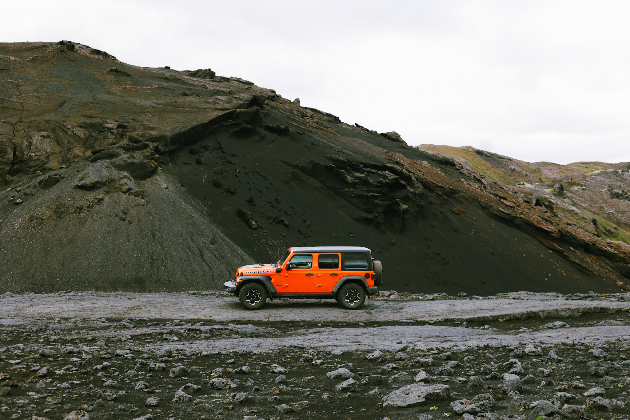
Vehicle Requirements: While F35 has been improved over the years and reclassified as Route 35 in some sections, it remains an unpaved mountain road. A 4x4 vehicle is recommended, especially for less experienced drivers, to handle potential rough patches and varying weather conditions.
Seasonal Accessibility: The route is typically open from late June to early September, depending on weather conditions. Travelers should always check current road statuses before embarking.
Road Conditions: Although there are no major river crossings on F35, the road can be bumpy, and weather conditions can change rapidly. It's essential to monitor weather forecasts and road conditions before and during your journey. The F35 presents an array of surface conditions, ranging from well-maintained portions to more challenging stretches. The initial part near Blöndulón offers a relatively smooth surface, allowing for highway speed. However, beyond that point, the road deteriorates into gravel and large rocks, necessitating a significant reduction in speed, especially untill the turn to Highland Base at Kerlingarfjöll. The speed limit changes to 40 km/h, and while traffic is minimal, cautious driving is essential. Be prepared for corrugated and tuff surfaces that characterize this adventurous journey through Iceland's rugged wilderness.
F35 Kjalvegur
Update 2024: Kjalvegur F35
As of 2024, road conditions on Kjalvegur (F35) have varied significantly. The northern section to Hveravellir is well-maintained and smooth. However, the road quality deteriorates further south. We were surprised to find that the stretch from the Kerlingarfjöll intersection to Gullfoss is particularly rough this year, with numerous potholes and rocks making the drive challenging.
Highlights and Attractions
Hveravellir Geothermal Area: Located near the northern end of the route, Hveravellir is a geothermal oasis featuring hot springs, fumaroles, and beautiful geothermal formations. It's also known as a historical hideout for the 18th-century outlaw Fjalla-Eyvindur.
Hveravellir
Kerlingarfjöll Mountain Range: Situated northeast of the route, this volcanic mountain range offers stunning rhyolite peaks, geothermal areas, and numerous hiking trails. It's a paradise for trekkers seeking unique landscapes.
Kerlingarfjöll
Mountain Huts and Campsites Near the Way:
Several mountain huts are conveniently located near the F35, providing shelter and a cozy atmosphere for travelers.
1. Áfangi Hut
Áfangi Hut and Campsite
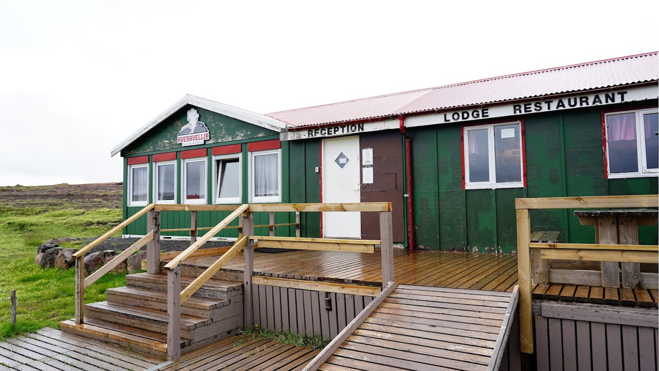
2. Hveravellir Lodge
Hveravellir Lodge
3. Gíslaskáli Hut
Gíslaskáli Hut
4. Þverbrekknamúli
Þverbrekknamúli
5. Highland Base at Kerlingarfjöll
Highland Base at Kerlingarfjöll
6. Arbudir Hut
Arbudir Hut
7. Hvítárnesskáli
Hvítárnesskáli
These huts offer a warm respite amidst the rugged wilderness, enhancing your Icelandic Highlands adventure. Plan your journey carefully, allowing time to explore the walking trails and natural wonders along the way. The F35 isn't just a road, it's an immersive experience through the heart of Iceland's breathtaking wilderness.
Safety Recommendations
Preparation: Due to the remote nature of F35, ensure your vehicle is well-maintained, carry extra fuel, food, water, and warm clothing.
Communication: Cellular coverage can be limited; carrying a satellite phone or personal locator beacon is advisable.
Travel Companions: Inform someone of your travel plans and expected return time. Traveling in convoy with another vehicle can provide additional safety.
Conclusion
The Kjalvegur Route F35 offers an unparalleled journey through Iceland's highlands, providing travelers with breathtaking scenery, historical significance, and a sense of adventure. Proper preparation and respect for the environment are essential to ensure a safe and enjoyable experience on this iconic route.
For a visual perspective of the F35 journey, you might find this video insightful: