Kerlingarfjöll Hot Spring: How to Get There
Kerlingarfjöll is a stunning Icelandic highland mountain range, reaching a height of 4,846 feet. It is part of a volcanic system that covers nearly 40 square miles and is known for its unique geothermal areas, including the Hveradalir Geothermal Area with its colorful landscapes. In March 2017, the entire area became a protected nature reserve, covering over 225 square miles.
To visit Kerlingarfjöll and its hot spring, plan your trip between late June and early September when access is easier. A 4x4 vehicle with higher clearance is essential, as the roads can be rough with potholes, deep puddles, and muddy ruts. Be mindful that off-road driving is illegal in Iceland, so stay on the designated tracks.
Getting There
- The drive takes about 3.5 hours from Reykjavik, depending on road conditions.
- Take the Iceland Highland Road F-35 (Kjölur) and then F-347.
- About 10 minutes before reaching Kerlingarfjöll, you will pass Gýgjarfoss Waterfall, where a new platform offers a great view.
- As you approach Kerlingarfjöll, you will see a sign for the Kerlingarfjöll Highland Base.
- A hut warden will likely request a donation for parking and access to the communal facilities.
Hiking to Kerlingarfjöll Hot Spring
- Distance: 0.9 miles (1.5 km) one-way
- Time: 15 to 30 minutes depending on your pace
- Elevation: Mostly flat with a few small hills
- Difficulty: Easy
- Terrain: A mix of dirt, clay, mud, and rocky paths along the Ásgarðsá River
What to Wear & Bring:
- Dress in layers and bring rain gear, sturdy hiking boots, a water bottle, and snacks. A dry bag for your belongings is recommended.
- No changing rooms or trash bins are available at the hot spring, so please leave no trace and clean up after yourself.
Things to Know:
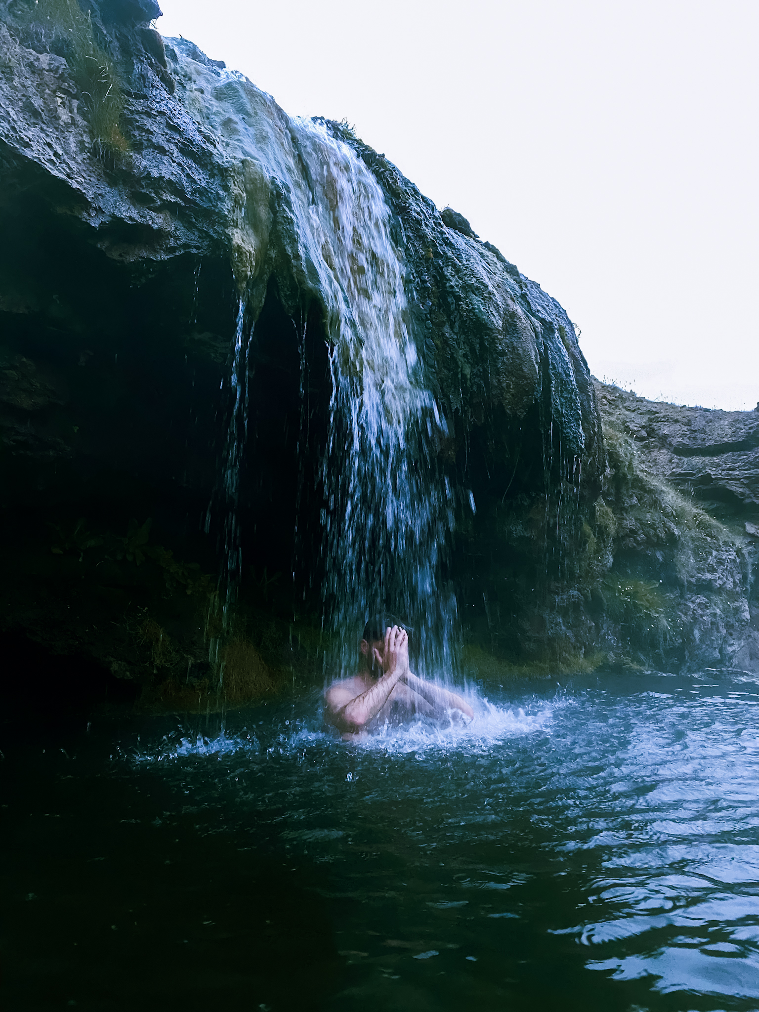
- The hot spring water is typically around 34-37°C (93-99°F), but during rain, it may feel cooler.
- It's best to visit during off-peak hours in the summer, as the space around the spring is limited and shallow.